An avalanche forecast sits between you and the snow. Most backcountry skiers glance at the danger icon, see green or yellow, and head uphill. That's how people die in terrain they've skied a hundred times. A forecast is not a permission slip, it's a conversation between a forecaster who has studied the snowpack and you, deciding whether the day's risks align with your objectives. Reading it properly takes five minutes and could be the most important time you spend before tour.
Start With the Bottom Line
Every North American avalanche forecast opens with a bottom line: a one- or two-sentence headline that fuses the day's danger rating, the main problem, and the forecaster's travel advice. Read it first. It is the single most important line in the whole product, the forecaster has already done the synthesis you are about to do, and the bottom line hands you their conclusion before you dig into the details. Everything below it (the danger rating, the problems, the rose), is the evidence behind that headline. Read the bottom line, then work downward to understand why it says what it says.
The Danger Scale Is Not a Binary
The avalanche danger scale runs from one to five: low, moderate, considerable, high, and extreme. Most backcountry days live in the low-to-considerable band. The mistake is treating moderate as "safe" and considerable as "too dangerous." Neither is true. Moderate means human-triggered avalanches are possible; you're managing risk, not eliminating it. Considerable means they're likely in certain terrain and aspects; terrain selection and route-finding matter enormously.
The scale blends three things the forecaster weighs together: the likelihood of avalanches, their size, and their distribution across the terrain. It is not likelihood alone: Low danger still warns of small avalanches in isolated areas or extreme terrain, and the rating climbs as slides get bigger and more widespread, not just more probable. With that in mind, here is how each level reads. At low danger, natural and human-triggered avalanches are unlikely, you're fine using basic route selection and terrain judgment. At moderate, natural avalanches are unlikely and human-triggered slides are possible on specific terrain features; you need selective terrain and spacing. Considerable means natural avalanches are possible and human-triggered slides are likely; careful snowpack evaluation and conservative decisions are essential, and you avoid the most obvious terrain or stay home. At high, natural avalanches are likely and human-triggered slides very likely, this and extreme are messages to not be there at all unless you're part of the forecast or rescue operation. Each level also carries official travel advice, and that is really what the scale is: Considerable says careful snowpack evaluation and conservative decision-making are essential; High says travel in avalanche terrain is not recommended; Extreme says avoid all avalanche terrain. The rating isn't just a probability, it's a recommendation.
What trips up good skiers is slope-by-slope variation. A considerable danger forecast doesn't mean every slope is dangerous. It means some slopes in certain aspects and elevations will have problems. Your job is to identify which ones, using the other half of the forecast.
The Problem Types Tell You What to Avoid
Below the danger rating sits a list of problems: wind slab, persistent slab, wet loose, glide, etc. This is where the actual hazard lives. Each problem type has a specific trigger, failure plane, and characteristic. You need to understand what distinguishes them, because your response to a wind slab forecast is completely different from your response to a persistent slab forecast.
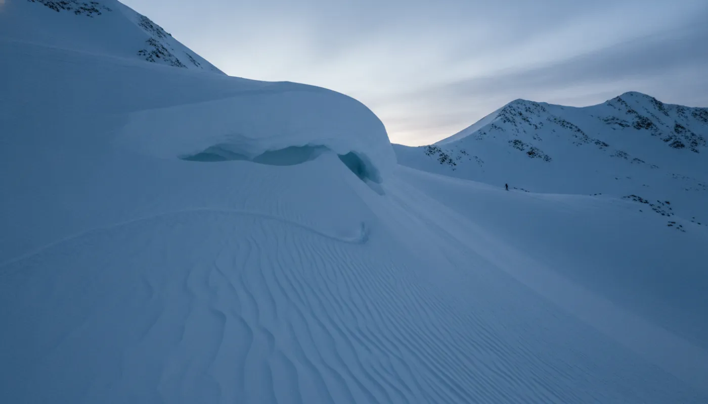
Wind slab is mechanically fresh, brittle, and reactive. It sits on a harder layer and fractures in thick plates. You trigger it by loading the slope shortly after it forms. The forecast will tell you which aspects and elevations got the wind, and you simply avoid those. If the forecast says "wind slab problem on north and northeast aspects above 9,000 feet," you ski south-facing or stay low. Wind slab problems are predictable and avoidable.
Persistent slab is the opposite: the weak layer is buried beneath stronger snow and has been there for days or weeks. You can't see it, and a small load can trigger a large fracture hours or days later. These problems require much more conservatism: you avoid the most obvious slopes entirely, travel on ridges, reduce group size, or avoid that terrain zone completely. A considerable danger with persistent slab is more serious than a considerable danger with wind slab, even though they're the same rating.
Wet loose and glide are spring problems. Wet loose happens when the snowpack loses strength as it warms; small sloughs and point releases come off; large avalanches are rare but possible. Glide is when the entire snowpack begins sliding on the ground; these fractures are massive and uncontrollable. If your forecast shows glide problems, avoid glide terrain entirely, it's not something you manage with good route selection.
The Rose Shows Where Problems Live
The forecast rose is a single bullseye graphic that combines two things at once: the eight compass aspects (north, northeast, east, southeast, south, southwest, west, northwest) as wedges, and the three elevation bands as concentric rings. Shaded or colored sections show which aspect-and-elevation combinations have active problems, and each avalanche problem carries its own rose. This is how you translate the problem description into a specific terrain choice. If the rose shows wind slab on north and northeast only, you navigate to south or west aspects. If the entire rose is shaded for persistent slab, meaning the problem exists on all aspects, then you're in avoidance terrain.
Those elevation rings are built into the rose, not shown as a separate graphic beneath it. The North American system uses exactly three bands: below treeline, near treeline, and above treeline, and the above-treeline band is the alpine zone, so there is no separate fourth band. Problems don't exist uniformly everywhere. A wind slab problem might live only above treeline; below, the snow is settled and stable. A persistent slab might be strongest in the near-treeline band where the weak layer is thickest. The rose and elevation data together answer the only question that matters: which slopes should I ski today, and which should I leave alone?
Read the rose as a constraint. It's not saying those aspects are dangerous and everything else is safe, it's saying those aspects have this specific problem. Your job is to avoid that combination. If you can't avoid it, if it's the only reasonable descent line, then you need to reconsider the objective entirely.
The Problem Description Is Your Action Plan
Forecasters don't just name problem types; they explain the layer structure, stability observations, and recommended terrain. A detailed forecast might say: "Wind slab problem on north and northeast aspects above 9,000 feet, formed in the past 24 hours, sitting on a firm crust. Stability tests on a north slope at 10,500 feet showed moderate skier triggering on the new layer. Avoid convex rollers and terrain steeper than 35 degrees on affected aspects. Lower angles and forested terrain offer protection."
That's your action plan in prose. It tells you exactly what stability tests the forecaster did, what they found, and what terrain management you need. If they flagged 35-degree angles, slopes steeper than that are higher risk; something flatter offers a margin. Be careful generalizing about snow depth, though: for a fresh wind slab sitting on a firm crust, thinner pockets may be less reactive, but for a buried persistent weak layer, the opposite is true. Shallow, thin spots (near rocks, or where a slab thins from thick to thin) are exactly where you are most likely to trigger a persistent or deep-persistent slab. Never assume "less snow means safer" on a persistent-slab day.
Not every forecast is that granular. A simpler forecast might say: "Considerable danger. Human-triggered avalanches likely on wind-loaded aspects above 8,000 feet. Avoid steep terrain on north and northeast-facing slopes." This one trusts you to apply common sense: rough terrain selection, don't ski convex rollers, use spacing, travel one at a time on steeper slopes.
Some forecasters include a specific confidence statement: "We have good data on this problem" or "observations are limited, confidence is moderate." Low-confidence forecasts mean the data is sparse; the problem might be more widespread or more serious than indicated. Adjust your conservatism accordingly.
Elevation Bands: Where Stability Changes
Mountains stratify. The wind that loaded the high peaks didn't load the trees. The weak layer that exists at 10,000 feet might not exist at 8,000 feet. Forecasts separate terrain into elevation zones so you can see where each problem actually lives, and the danger rating itself is often issued per band, so you can have Moderate below treeline and Considerable above treeline on the same day. A persistent slab problem might be strongest at 9,000 to 11,000 feet, with higher elevations and lower elevations both somewhat safer. That doesn't mean they're safe, just that the hazard is concentrated in that band.
When you're scouting a tour, identify which elevation band you'll spend time in and cross-reference the forecast. If your route climbs from 7,000 feet to 10,500 feet and the forecast's main problem band is 8,500 to 10,500 feet, you're in the hazard. If the problem is above treeline and your route stays forested, you've reduced your exposure significantly.
Some terrain is elevation-agnostic. A glide problem at 6,000 feet on south-facing slopes is serious regardless of aspect elsewhere; you simply don't climb into that band. Persistent slabs at all elevations mean the forecaster is concerned about the entire column; elevation won't save you.
Putting It Together: Forecast to Trailhead
You arrive at the trailhead with the forecast read. Now you translate it into actual terrain management. A considerable danger with wind slab on northeast aspects above 9,000 feet means: climb whatever you want below 9,000 feet (other hazards aside); at 9,000 feet, track your elevation and aspect carefully; avoid the northeast-facing slopes above 9,000 feet entirely; your descent should come off southern, western, or eastern aspects.
A considerable danger with persistent slab on all aspects and all elevations means: the problem exists everywhere. You're either very conservative (terrain selection, spacing, stability checks), or you find a different objective entirely. A considerable danger with wet loose in spring sunlight means: climb early, get off aspect before late afternoon, accept that you can't prevent all sloughs, and plan a descent you trust below the wet layer.
Combine the forecast with your own observations. If the forecast describes wind slab on north aspects and you see wind-loaded powder there with sastrugi nearby, the forecast is tracking. If the forecast says persistent slab is unlikely to trigger and you find collapsing on a gentle slope, something is different than expected, this is when you become more conservative, not less.
The forecast is informed authority, not gospel. It's built on data collected yesterday and observations from a sample of the range. Your observations on a specific slope matter. But respect the baseline: if a professional forecaster spent the morning digging stability tests and concluded considerable danger with persistent slab on certain slopes, they've seen something real. Your job is to either avoid that terrain or accept the risk consciously, knowing why.